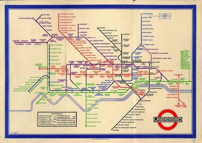
A friend of mine has a Grace Scurr 1921 – 1996 75th Anniversary Edition Filofax which arrived without a map. So I scanned one of mine to send along. I thought I would show it here. The paper is thick and textured and the Tube map has a nice retro feel to it.
This map is more geographically accurate in terms of location and distance than the…..
…..map that Harry Beck first designed in 1931 (he was not even commissioned to do it, can you believe – he did it in his spare time) and which has become the template upon which many underground system maps have been based since then. Beck felt that geographical accuracy was not relevant – because all people needed to see were stations and connections – so all the stations on his map were equidistant.
First version…
Latest version…I find this Harry Beck’s one very easy to follow as does everyone else, which is probably why it is so popular. However, some of the stations are only five minutes’ walking distance apart which is not clear from the map, but you only really get to know that if you have lived in London a while.
And the Stockholm underground map, based on Harry Beck’s.

I can recommend a trip to the London Transport Museum in Covent Garden where you can read about these and see how the underground developed. Yep I am a nerd!


Those early maps are fascinating! What I find particularly interesting is that they show stations which aren’t even there any more, like Strand, British Museum and City Road, and some which have changed name – Queens Road is now Queensway for example. But the typeface on the earliest one – what were they thinking? Almost unreadable by comparison even to the early Beck schematic map. Thanks ever so much for posting these!
My very great pleasure Paul!